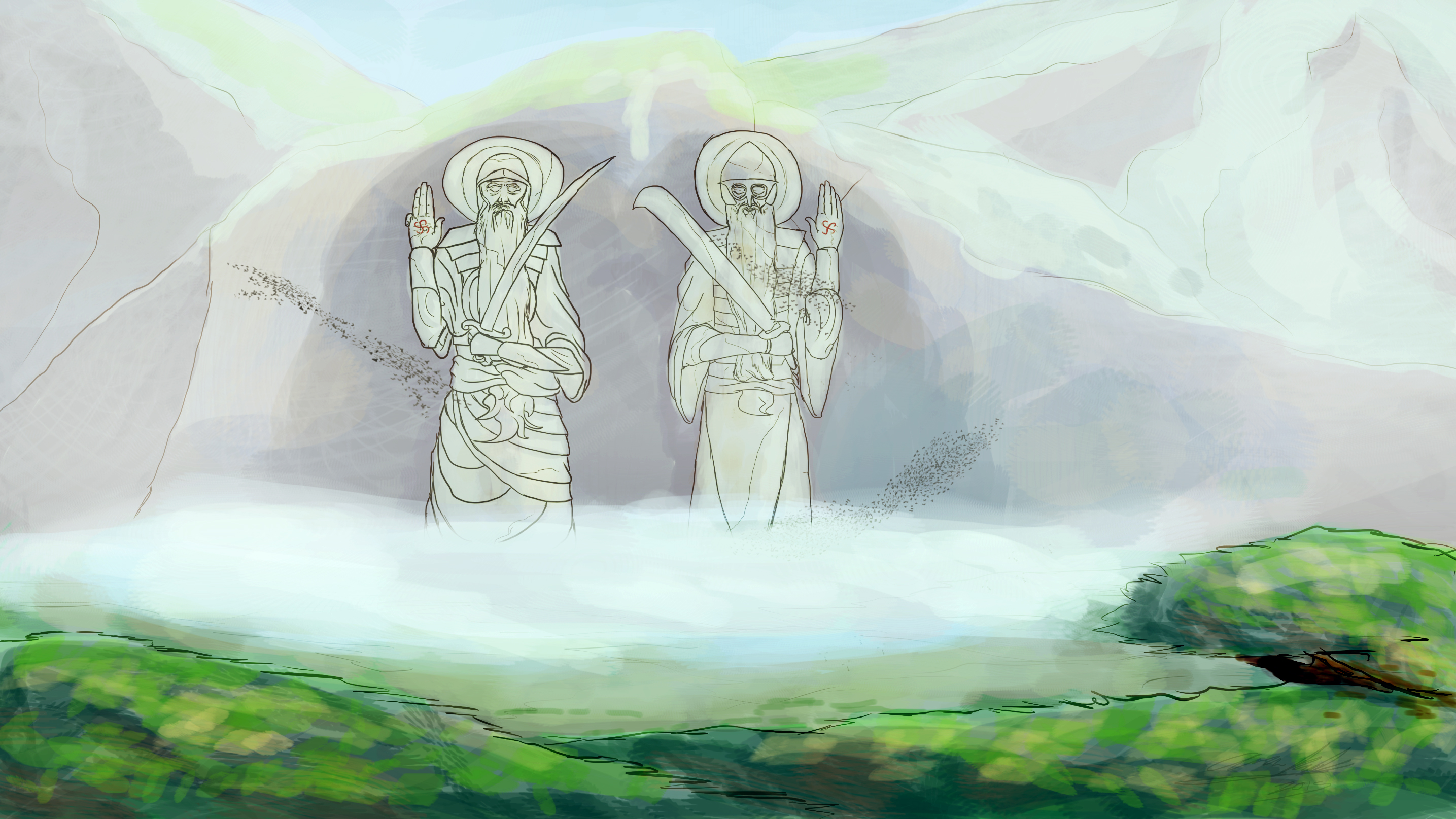
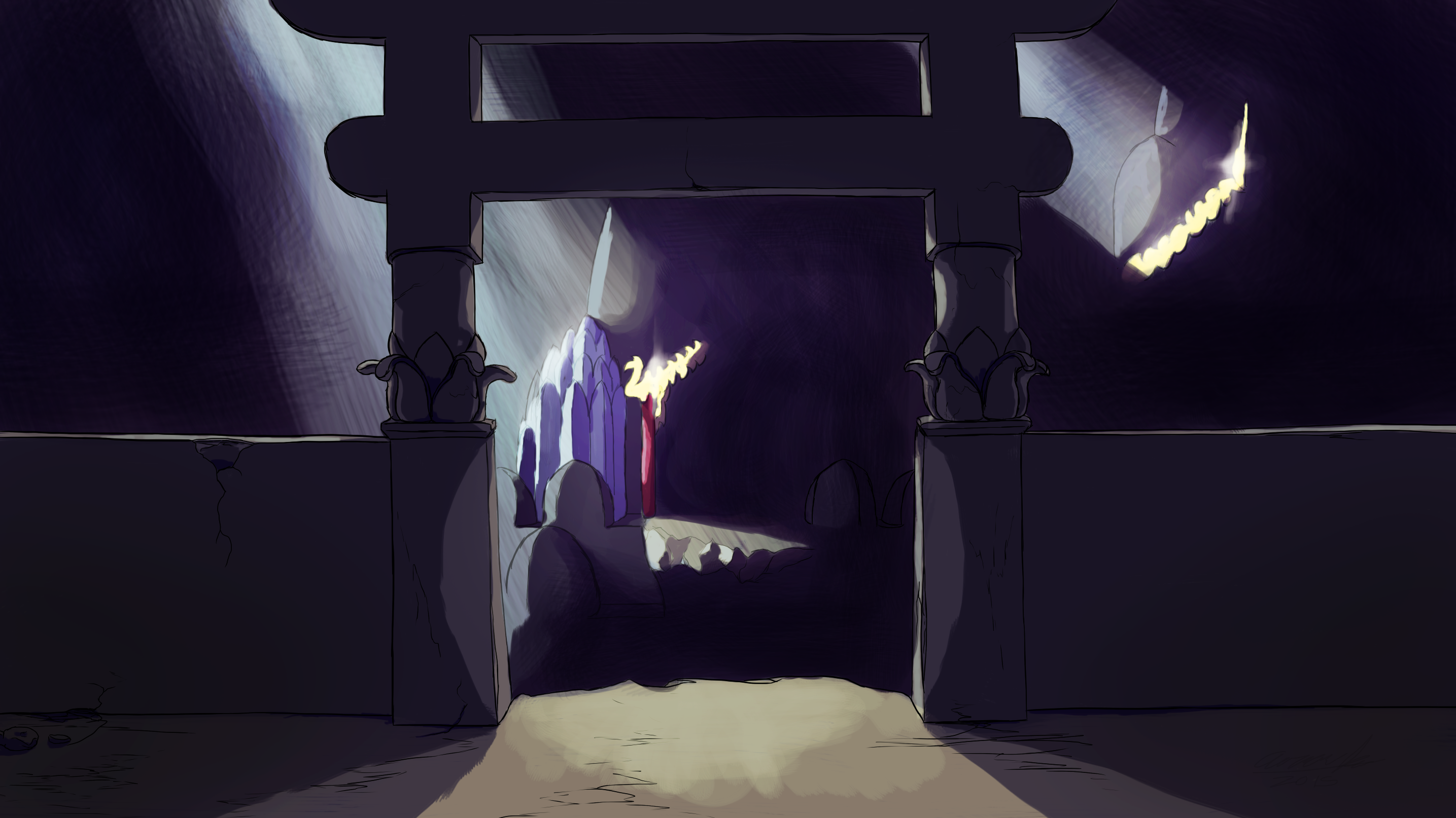
The world of Gaṇājya, three centuries after the collapse of the Empire of Vishashtan. The Samraat – Emperor - that ruled from the stone below are long gone from the physical world, though their legacy remains carved in the physical stone and in the background of the surface kingdom's lore and legacy. They may have traded, they may have fought with, they may have fought alongside, or they may have been slaves and subjects to the Visha.
And their underground remains, though unfit for civilization. But enough more than enough is there as to be dangerous or rewarding.
Some basic information about the map:
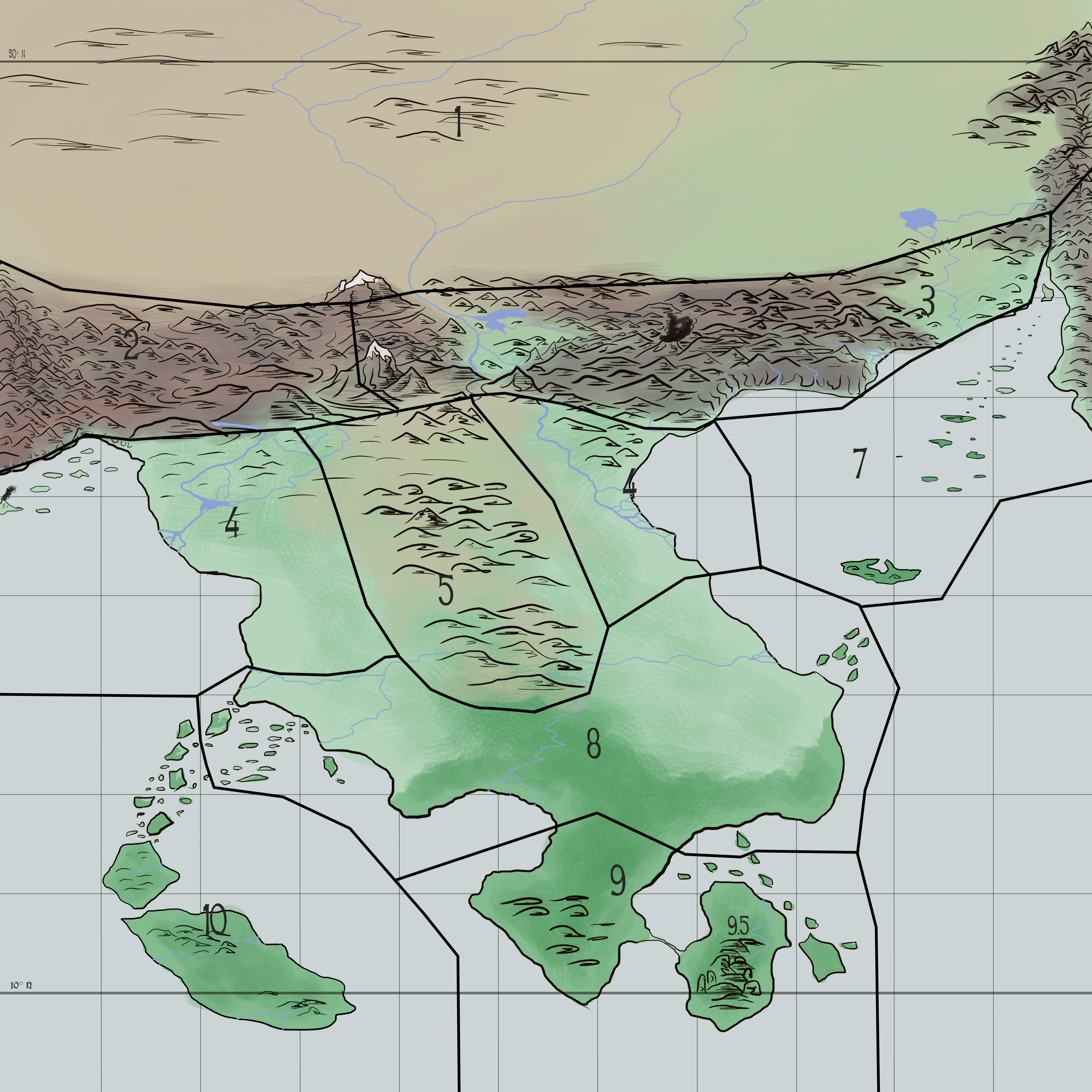
In general the region depicted covers a land area roughly equal to half the land area of Eurasia. A rough estimate would be about 20,000,000 kilometers square. So immense, and there's plenty of room for diversity, even with the Vishput's legacy enforcing a sort of Indian theme across the southern lands. And as shown I have included the 10 degree and 50 degree parallels. This world being the same in size to Earth that makes the distance north-south between the two 2,757.7 miles.
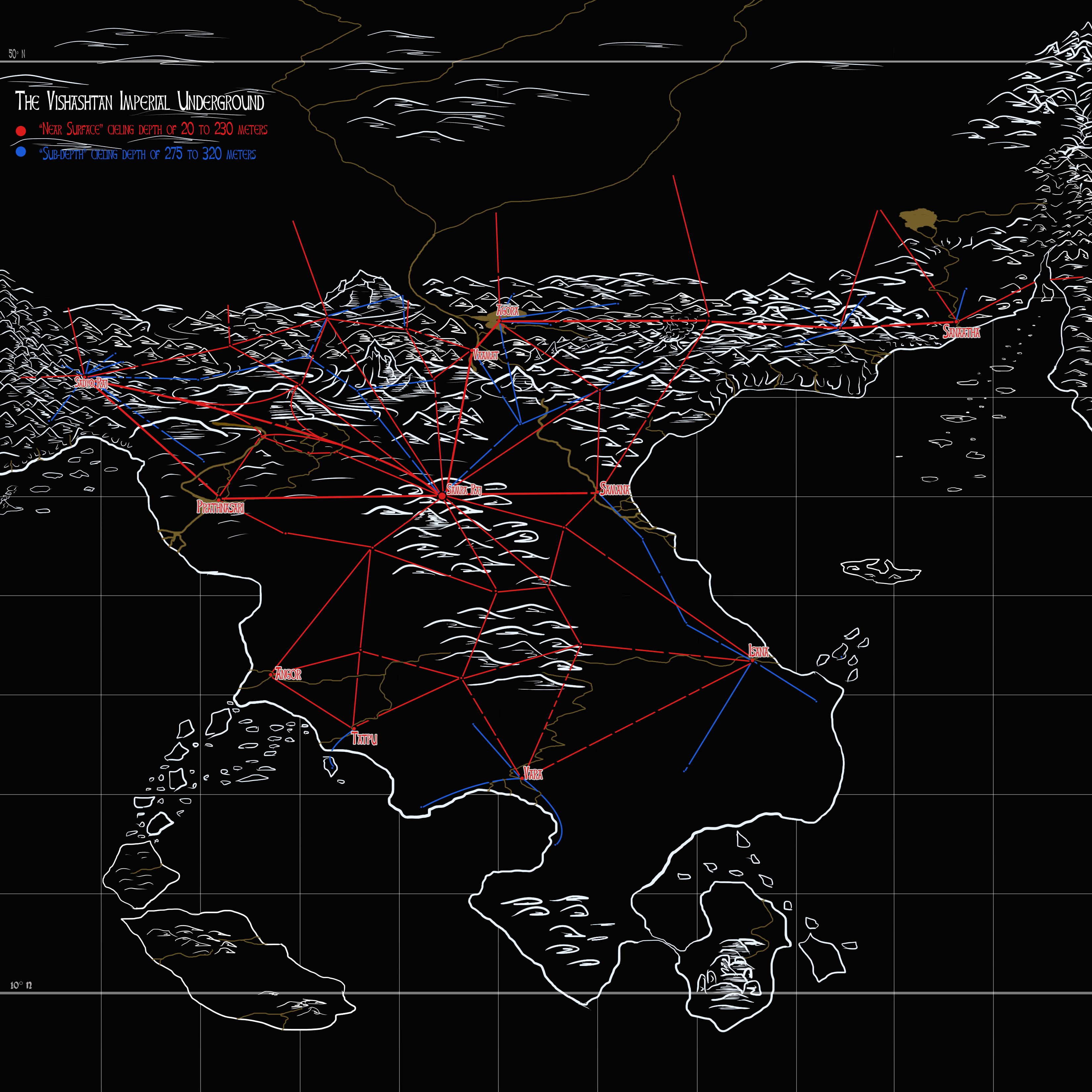
Now, those aren't the only details. I have the map broken into regions as well an underground map for important Visha cities and major underground highways that they built. But first, the immediately important thing...
Regions
Regions will not be named. That's up for the players to determine. As well as assigning some geographic of climate differences regions also help in dictating some cultural consistency in a given area.
Region 1 – Faced with a massive mountain shield at the south the massive deserts beyond the mountains march far into the insurmountable distance. And defined by high altitude steppes in the south as the mountains there crawl and peter northwards and a vast arctic wasteland the further north it marches.
Though small icy oasis dot the landscape, its singular and major water source is its long river that meanders to the northern lowlands where it meets the regular cold winds that blow off from the arctic. Unfettered by natural barriers the cold winds blow cold and dry from the tundra far beyond the imagination of the peoples of the south.
The landscape however becomes much greener pasture in the east where a break in the mountains is wide enough for rainstorms to be much more common and for the area to be effected by summer wet seasons. The resplendent grasslands here march as far as the eye can see to the mountains on the eastern border, beyond which a vast unknown civilization of people. But keeping the nomads here from them is a thick jagged series of ancient mountains laying guard on either side of steep broken ravines once attempted by the Visha, but their failures turned to rubble and now their ancient tunnels run into emptiness as they plunge off into the abyss with no sign or signal of having ever gone further. Since their fall glacial springs have opened from the peaks above and spring waters flow down into or gurgle up into these tunnels to cascade back down to the dark earth into the ravines from their high-ways turned storm drains.
Region 2 – Forever considered the ancient homeland of the Vishput, the western mountain shelf is a jagged maze of high stony peaks forever growing. Earthquakes are not uncommon. This mountain landscape is not a stranger to rainwater-fed streams or mountain-glacier fed streams that trickle through the valleys and caves until it meets the shore lands where they become violent torrents leading short-lived lives as they crash into the foamy sea at the bottom of granite and marble cliffs.
Being the former historical heartland of the Vishput and the city of Sadyo Raj wanderers and yak herdsmen often stumble upon the gaping maws of the ancient tunnels the Vish once stormed out of in ancient bygone times. However these tunnels now lay dark or silent, save for the nightly raids by the bat-creatures that occupy the old homes of the Underground Masters.
Still, it isn't all impregnable. Two major mountain passes wind through the hardened peaks of the mountains, twisting alongside cliffs and down into gravel-filled valleys. All the while on the border between regions 2 and 3 the two tallest mountains in the range loom over head, giving a watching eye to the progress of time below as they rise over the heads of all, like hands of the gods to scratch the sky.
Region 3 – The eastern extension of the mountains certain fortune has befell the peaks, granting more readily secluded abundance in the fortress peaks. From the peaks glacier water flows down, mixing with spring water to tumble down the rocks into secluded valleys and basins where life blooms. The shores are dominated by sharp cliffs, with only a small delta break, the sandstone that had once been there washing away into the sea.
The harsh geographic intensity of the areas isn't without peace and earthquakes are a common occurrence, having even thrown up a single significant volcano.
Region 4 – Though unusually split it does not mean they need to be treated differently, nor the same. Fed by rivers sourced in the high mountains this twin area is lush with agriculture with a rich dark soil and thick green grasses. Fed by tropical currents from the south the waves bring warm weather and warm waters as the crystal blue waters wash up along the coasts, drinking in the crystal clear waters that pour into them from the wide and lush deltas that form. Their northern borders are defined by highlands and hills as the land climbs up to the mountains, then to rich forests as they crawl to tropical lowlands to the south and inevitably jungle.
Region 5 – Once thought of as being the richest and most beautiful heart of Gaṇājya this sliver of interior land has long since been carved up and deeply defined by the Vishput. Forests felled and soil turned over until dead the grasslands have grown infertile and the area largely taken over by desert. Underneath the dunes, clay hills, and swampy pools lies the Visha capital of its later and golden half of their Empire. The city of Samra Raj, where all tunnels lead inevitably.
Region 6 – See one of region 4.
Region 7 – Perhaps the smallest of the regions in term of land area, region 7 is considerably defined by its sleepy archipelago. Part of the old chain of geologic activity that splits the plains and deserts of region 1 from the east it's become tired and old, but all the same powerful. The old mountains that were once fierce have eroded down since long before the Visha.
Region 8 – The sponge that absorbs all. Region 8 takes much of the climate brunt thrown off the ocean. Monsoons and tropical rains. Thick jungles and spongy swamps are a defining element.
Region 9 – Sharing the same weather as its northerly neighbor, this area comes included with an island half-connected to the mainland by a narrow, sandy land-bridge. On the island mountains of hard granite raise like perfect pillars from the ground, crowned with trees dwarfed by the size of the rocky pillars that are their homes. Region 9 also marks the point of lowest Visha influence, second only to the islands.
Region 10 – These sandy islands once perhaps stood at the bottom of the sea. But thousands of years ago were thrust upwards, or the sea was dragged down around it. The sandy beaches and sandstone interior hills provide a large tropical land of semi-isolation and one of the largest regions not wholly influenced or conquered by the largely terrestrial Vishput. In trade and exchange the island was long connected with the mainland through its series of large islands that form an arcing archipelago tethering it to the mainland.
It is here also that the islands capture many of the violent storms that may pass northward on the western side, making the seas of region 4 there more placid than its eastern brother.
Visha Underground
Key in corner, marks only the most significant highways and underground cities.
If you want to see in full screen and clicking the image here won't work.Think of the marked tunnels as being about the width of five-lane highways at least and tower in height.